Sunday, August 29, 2010

The Whole Enchilada 2010


The Whole Enchilada conjures up an image of an Epic ride at first, but then you start thinking that an enchilada is like a burrito but slathered in sauce. Wet slippery sauce.

The Whole Enchilada is a ride that starts out in the La Sals, a mountain range 20 or so miles south of Moab. The La Sals have 12 peaks higher than 12,000 feet which is amazing considering that Moab itself is just over 4,000 feet.

We started our ride at about 10,000 feet just south of Burro Pass and within a mile or so had to climb up to 11,200 feet over Burro pass. Right off the bat, a sprint to the top.


I don't know about everyone else, but at 11,000 feet with my heart working as hard as it could and the thin air, it was hard to keep the pedals moving.

Then came the Rain
We knew we were risking a wet ride earlier as we shuttled up in Jared's truck and saw the strange looking clouds blowing around Moab, but it appeared that they were not settled in the La Sals. Maybe they would just blow through. Wishful thinking.

But still we were excited to get on the trail...


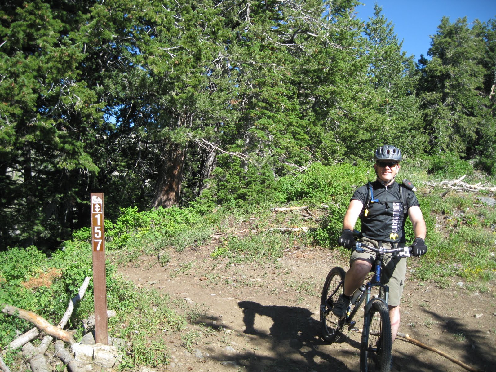
Notice how clean and fresh we were before the rain and the mud. Yeah, the mud came after the rain, a prewash and then a protective coating was applied.


As we climbed up to Burro Pass it started sprinkling, then raining then raining harder, then sprinkling, etc. Eventually it was apparent that the clouds had settled in and our best option was to ride through the sauce and get off the mountain.

There were several cattle guards like this one that we rode through during the day.


The forest around Burro Pass and the La Sals in general was pretty thick and prestine. The trail was carpeted with either pine needles or rocks with an occasional sprinkling of tree roots.


Coming down the La Sals was challenging, the rocks were wet it was muddy and the stream crossings were running pretty high. But the forest was beautiful, the water was clear and fresh and hey, the trail was not dusty.

It was cold. If anyone got hurt up here, as remote as it is, hypothermia would be a risk. Fortunately our crew got down and started on the Kokopeli trail safely.

After the the trail leveled a bit and actually had a few climbs, we hit some mud.

That's where the enchilada sauce really started. The mud on the road was just as sticky as hot gum on the pavement. You know when you walk across a parking lot in the summer and step on gum that some slob has spit out earlier. That gum stick to your shoe and is really tough to get off. Yeah.

The mud caked our tires and then globbed on to the forks, rear triangles, chains and derailleurs until it seized up our wheels and we had to stop about every 20 to 100 feet and scrape the tires and forks clean enough to free the wheels. Several of us crashed as the mud seized the wheels and sent us mud skiing out of control into the sogginess.

After a couple of miles of this we climbed up out of it into the drier, slickrock part of the UPS trail. We rode the UPS trail, hoping that some mud would drop off of us but it clung like a tick to Rover's heine. That was annoying, but it also caused a nasty mechanical failure.

Jared was riding along on a slickrock section when you heard that metal twang and click medley that signals a possible mechanical failure. Because the mud had now dried into a thick pottery, it had seized the gears on his derailleur. If the gears wont turn, then the gears follow the chain on its journey around the cassette. This will break and twist some essential drive train parts.

Yeah, the derailleur hangar snapped and other parts bent. All the kings horses and all the kings men, couldn't put that derailleur back together again.

So Russ and others helped set the bike up as a single-speed non-derailleur bike. I think they pumped up the rear air shock to max also to make it as rigid as possible to prevent the chain from stretching too much as could happen when the suspension is active.

At the junction to the Notch, I tried to dry some of my clothes. The sun had come out and I was wet, waiting for the derailleur repair team to join me I took a picture from there of the expansive desert to the north...


The group soon rejoined me and we decided not to go see the notch and just head out since we were a little behind schedule.

We descended to the LPS, skipping the notch and riding on to the Porcupine Rim single track.

I had never been on the Porcupine Rim trail and it was quite a change from the earlier terrain of the day.

Ledges, ledges, ledges. Yeah, you might say it was a ledge fest. I was able to launch off of a few with good results but most of them I went around or just dropped off of because the landings looked sketchy. I know that the rest of our group was launching from ledge to ledge and I was envious, but my skill is not at that Jedi level yet, and I prefer to live to ride another day.

I did however try to ride one-handed for a bit to get some trail video...


Towards the end of the ride, I caught Terry and Matt riding some of the rim...

Finally out towards the Colorado River, the trail decended to the road and we finished the ride.

Terry and Russ drove up to the La Sals to pick up the shuttle and the rest of us rode along the Colorado River and into town, which was quite an effort in itself because of the headwind.

just hung out at the Community Center in downtown Moab, debriefing the ride and generally resting for the drive home.


Check out this Garmin GPS Link for more details of the ride.


Tuesday, August 24, 2010

Horse Flat, to Julie Andrews and Bear

It was actually a little cold this morning. Like 50 degrees at the split.

We shuttled up to the Summit Trail and rode to Snow Gage and over to Timpanookee.

From there we headed up to Julie Andrews Meadow and came down Bear.

I only have one short video of the boulder turn on Bear.

We had quite a crew though with Jeff, Russ, Terry, Matt, Bob, Steveolyo and Royce.

Happy Trails.

Sunday, August 22, 2010

The Unexpected Epic

Yeah, this was unexpected because I thought it would be the normal Saturday ride, you know 2 or 3 hours...

The plan was to hit Pole line pass, Ant Knolls, Ridge Trail 157, upper Mill plunge and dive, lower Mill to Tibble Fork Reservoir.

We met at the split and waited until 6:15.

Terry, Royce and I drove up to Tibble Fork and parked. We started riding up to pole line pass in pleasant 45 degree weather.

Before we left I noticed Adam and Aaron had pulled up. They were also on their way to ride up to pole line pass. Terry and I were riding with them for a ways until we could no longer keep up.

Somewhere we lost track of Royce. Later he caught up with us and told us he had a pinch flat.


The ride up to pole line pass is not very technical, it's just a graded mountain road, but it is relentless and climbs from 6540 to 8920 (2380) in about 8 miles.

After getting up Pole Line Pass, we went to the left and started up Ant Knolls.


After some riding up Ant Knolls, there is a fork, we went left.

At that point it was just Terry and I, Royce was out of time and had to head back.

This was the best trail of the day, just beautiful scenery, views into mineral basin, peaks all around us and soft trail winding up and down across the mountain.


This ride is an out-and-back which ends where 157 drops down the hill to the east or west.


Thus ended the easy part of our journey. We rode the beautiful trail back to Pole Line Pass and then followed 157 to Mill Canyon.

I must say that part of the ridge trail was tough, climbs that rob you of your breath, not so much breathtaking, as breath robbing.


Finally after many terrifying climbs which started as awesome, then tough, then hike-a-bike, we finally started downhill towards Mill Canyon. The upper part was rideable, but really you were surfing many baby head boulders, well I mean baby tyrannosaurus rex's. Because the boulders were more pointy.

After upper Mill Canyon, we got on Lower Mill Canyon and it has recently been rerouted. I liked it, wide switchbacks that were groomed. This was welcome trail after the loose rocks of torment that we had ridden down. We did see a Moose mama and her calf.

Finally we got to the parking lot at Tibble Fork a mere six and a half hours after we started.
Total elevation gain: 4500 feet.

Here's some extra photos of the trip...

Forest Lake...


Tuesday, August 17, 2010

Summit Trail to Mud Springs - Tibble Fork

This morning was a good ride, we met at the split at 5:30, shuttled up to Salamander flats.

Russ, Royce Terry and I were in the first load, others joined later.

We unwittingly parked near some tent campers, and I think we woke them up, so we quietly unloaded the bikes, and turned on our lights and headed up Willow Hollow to the Summit trail.

At the Summit Trail, Lionel and Matt joined us.

Shortly after the turnoff to Snow Gauging, we turned to the right on an overgrown trail that dipped wildly into a fun little ride. Terry might have tried out his helmet once, and we flew down the trail in the dark like secret agents in the night.

I don't know the name of the trail, so if someone wants to comment on that, it would be great to know the name. How about "Nose Break"?

Well that trail met up with Snow Gauging and then we went on to climb over to Mud Springs. We decended Mud Springs to Tibble Fork trail and came out over the Tibble Fork dam.

I think I missed a trail name here or there, but since I'm struggling with the names, I'd love to be corrected.

Here's a video of a piece of Mud Springs Trail.


Later we actually saw a rattlesnake, never mind that it was on the asphalt, by the split, and run over beyond recognition.

Saturday, August 14, 2010

Horse Flats and Whoops beats the pavement any day

Saturday we met at 6AM at the split. The temperature was actually cooler than I expected, probably 55 degrees, and it was still dark.

I erroneously thought that I'd need a light, but by the time we shuttled up to the summit the trail was bathed in that soft morning light of American Fork Canyon.

While we drove up to the Summit Parking Lot, we noticed a ton of cars parked on the shoulder from the Timpanookee Campground turnoff to past the trail crossing. Probably due to several factors, the American Fork Canyon was immensely popular this Saturday.

First, the entrance was free, normally it's six bucks; Second, there was the 1000 Warriors bike ride and; Third, it was a Saturday.

We started biking up the Summit Trail and went straight through Horse Flat. At the back of Horse Flat we climbed a challenging piece of trail that some could almost clean, but at the top there are some treacherous roots that bar passage. They seem to say, "None shall pass".

After the climb we descended some fun single track which shall remain nameless until I can find the name. It had a neat little log jump. I don't jump it though, I kind of plop my front wheel down, which as you can see from the following video, is the usual way for most of the riders. I think if you got too much air your speed would preclude control and you might not make the turn that follows.


Down this trail we went for a while then we connected to the Deer Creek South Fork trail and rode the Whoops through Mexican Flats and continuing on the Deer Creek South Fork Trail to Ridge trail 157.

We stopped for a minute or two at the four-way and saw Steve. He was riding in some interesting looking pants and so Russ had to show him that he had the same pants under his pants.


Hanging out at the four-way


The climb from the four way to Chain Break is especially challenging. Today I managed to clean it as did Matt and Russ as you can see from this video...


Chain Break connects to Mill Canyon which is the trail we descended to Tibble Fork Reservoir and down the pavement to our cars.


Here's a gps reference to the ride.

Thursday, August 12, 2010

Pine Hollow Iced the Cake

Who says you can't have your cake and eat it too? Thursday morning we built the cake and then iced it and ate it.

Today it was Russ, Matt, Royce and myself. We shuttled up to the Summit parking lot. From there we headed up the Summit trail, made a right on the Snow Gauging trail and then headed over to Timpanookee.

On the Snow Gauging trail or a connector from that to Timpanookee, Russ pulled out his handy saw and with Matt's help he cleaned off some deadfall.


Trail Maintenence


From the Timpanookee shack we rode up a little bit of single track and then hit the dirt road up to Julie Andrews Meadow.


The turn off to Julie Andrews Meadow. I wonder if she knows about this meadow.


The temperature was perfect, probably 60 or 65 degrees, no noticeable wind and best of all, no Motorcycles the whole trip! Not even Horses.


Julie Andrews Meadow


Yeah I know, we have to share the trail, and we do, but the Motorcycles sure are noisy and stinky and seem out of place in some of these areas. I used to ride a motorcycle in the back country. This was before 1979, back when mountain bikes were rare, especially in Utah and there was not a need to evolve. Now that I have evolved I would like to see others evolve too!


Here we are riding the top of Bear after the long climb up to Julie Andrews Meadow .


So after dropping down Bear to Mutual Dell I thought maybe we were finished, but to the joy of my spirit, Russ was suggesting to ride back up to Trail Crossing, single track over to Pine Hollow and ride back down Pine Hollow. I had never ridden that so it was awesome to hit some new trail and add more time on to the ride. Pure sweetness.


For the GPS tracking info on the ride, follow this link: follow this link